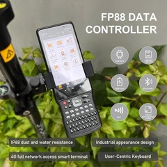


R26 V1 Rover GNSS GPS Equipment with LP80 Data Collector RTK Receiver LandSurvey
Specifications
| Return Shipping Will Be Paid By | Buyer |
| All Returns Accepted | Returns Accepted |
| Item Must Be Returned Within | 30 Days |
| Model | R26 V1 Rover |
| MPN | R26 V1 Rover |
| Country/Region Of Manufacture | China |
【Notes】Surveying software already installed in Handheld and Permanently valid.【GNSS Surveying System】Small size, easy to carry and operate.The GNSS receiver can receive our new GNSS global corrections service delivered via band satellite and internet to abtain centimeter-level positioning accuracy.【All-in-one design】Built-in BT, wireless, storage, positioning,inertial navigation, antenna and other modules tomeet various needs of measurement work.【Two operating modes interchange】Base station mode and rover mode can be switched freely according to needs.【 Innovations】The GNSS incorporates the latest innovations such as an inertial module providing automatic poletilt compensation in a very compact design.【Correction type】Wireless, CORS, TCP/IP【Supported file formats for import】dat, txt, csv, rw5, raw, kml, kmz, ncn, pxy, crd【Supported file formats for export】dat, txt, csv, dxf, shp, kml, kmz, gpx, jpg, html, xls, ncn, pxy, crd, xls. R26 static surveying, export text format file. Can convert text format to RINEX format file by SMAJAYU convert toolPlease note that:When you receive the new R26 device.Long press the power button to turn it on.If the light does not respond, or the light flickers for a while and then goes out.It means that the device is out of power.Please connect the adapter to charge it.What can do with this component:Field data survey, Point survey, Fragmentation survey, Control point survey, Point Stakeout, CAD, Straight line setting out, DSM Stakeout, Stake Road and other functionsReal Measurement ExperimentConclusion of environmental test:Please Surveying in a open place without block! RTK can usually be fixed if Rover in an open place without block, and RTK is float in places where there are trees or buildings that block the signal and the signal is not good.Surveying with Both Rover and Base can make sure 1-2cm precision.What's in the box?
Related Items